0 items, total £0.00

Hot Search:
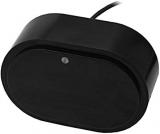
Garmin 010-00970-10 eTrex 20 Outdoor Handheld GPS Unit

;)
;)
;)
;)
Items Description
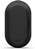
Garmin eTrex 20 Outdoor Handheld GPS Unit Garmin eTrex 20: Use in the car too Garmin eTrex: Navigate with Ordnance Survey mapping eTrex 20 takes one of the most popular and reliable GPS handhelds and makes it better. Redesigned ergonomics, an easier-to-use interface, paperless geocaching and expanded mapping capabilities add up to serious improvements for an already legendary GPS handheld. eTrex 20 is versatile. It's tough. And it's built to handle whatever Mother Nature can dish out – and more.Find FuneTrex 20 features paperless geocaching by supporting GPX files for downloading geocaches and details straight to your unit. Visit OpenCaching.com to start your geocaching adventure. By going paperless, you're not only helping the environment but also make your geocaching much more fun. eTrex 20 stores and displays all the information you need including location, terrain, difficulty, hints and descriptions, which means no more manually entering coordinates and paper print outs. Simply upload the geocache to your unit and start hunting for caches. Garmin eTrex 20: Have fun geocaching See The WayeTrex 20 has an enhanced 2.2 in 65K colour, brilliant, sunlight-readable display. Durable and waterproof, eTrex 20 is built to withstand the elements. It has an upgraded interface yet retains its legendary toughness to withstand the elements – be it dust, dirt, humidity or water, none of which are a match for this navigator.Add MapsWith its microSD™ card slot and 1.7 GB of internal memory, eTrex 20 lets you load our range of Ordnance Survey maps such as Garmin GB DiscovererTM and hit the trail, plug in BlueChart® g2 preloaded cards for a great day on the water or City Navigator NT® map data for turn-by-turn routing on roads (see maps tab for compatible maps). eTrex 30 also supports BirdsEyeTM Select map download service, that lets you download premium raster maps to your device and integrate them with your existing maps. Keep Your FixWith its high-sensitivity, EGNOS-enabled GPS receiver and HotFix® satellite prediction, eTrex locates your position quickly and precisely and maintains its GPS location even in heavy cover and deep canyons.Go AnywhereWith an array of compatible mounts, eTrex 20 can be used on your bicycle, boat, in your car or motorbike and off-road vehicle. You even get turn-by-turn directions with the auto mount and City Navigator NT® maps. Wherever you think you might take eTrex, it has the mapping and mounts to get you there.Go GlobalThe new eTrex series is the first-ever consumer-grade receivers that can track both GPS and GLONASS satellites simultaneously. GLONASS is a system developed by the Russian Federation that will be fully operational in 2012. When using GLONASS satellites, the time it takes for the receiver to "lock on" to a position is (on average) approximately 20 percent faster than using GPS. And when using both GPS and GLONASS, the receiver has the ability to lock on to 24 more satellites than using GPS alone. Box Contains eTrex 20; USB cable; Owner's manualSpecifications of Garmin 010-00970-10 eTrex 20 Outdoor Handheld GPS Unit
Brand Garmin Model Name eTrex 20 Special Feature Touchscreen Screen Size 2.2 Inches Connectivity Technology Wi-Fi Operating System Garmin Item Model Number 010-00970-10 Product Dimensions 3.3 x 10.16 x 5.33 cm; 141.75 Grams
![Apple Watch SE (2nd Gen, 2023) [GPS + Cellular 40mm] Smartwatch with Midnight Aluminum Case with Midnight Sport Loop One Size](images/202310/thumb_img/72674_thumb_G_1697122136524.jpg "Apple Watch SE (2nd Gen, 2023) [GPS + Cellular 40mm] Smartwatch with Midnight Aluminum Case with Midnight Sport Loop One Size")
, Black Leather with Silver Hardware")
Most People Viewed These Watches


Shop by Brand
- Apple(116)
- Omega(205)
- Breitling(355)
- Fitbit(98)
- Michael Kors(489)
- Invicta(804)
- Seiko(449)
- Orient(299)
- Fossil(77)
- Casio(80)
- Citizen(354)
- Boss(298)
- NIXON(391)
- Garmin(330)
- TAG Heuer(264)
- Diesel(116)
- Luminox(289)
- Tissot(221)
- kate spade new york(81)
- Swatch(1020)
- GUESS(1432)
- Tommy Hilfiger(1047)
- Bulova(1202)
- BURBERRY(230)
- Emporio Armani(203)
- Samsung(219)
Best Sellers


Recently Viewed

You May Also Like
 - Blue Aluminium Case with Deep Navy Sport Band (Renewed)")


 - Midnight - Regular")


 44mm, Aluminum, Black")
link:
[Michael Kors Watches] |
[Michael Kors Watch Men] |
[Michael Kors Watch Women] |
[Invicta Watches] |
[Casio Watches] |
[Seiko Watches] |
[Fossil Watches] |
[NIXON Watches] |
[Tissot Watches] |
[GUESS Watches] |
[Citizen Watch] |
[Diesel Watch] |
[BURBERRY Watches] |
[Coach Watches] |
[Bulova Watches] |
[Stuhrling Original Watches] |
[Samsung Watches] |
[Armani Watches] |
[Luminox Watches] |
[Orient Watch] |
[Boss Watch] |
[Garmin Watch] |
[TAG Heuer Watch] |
[Tommy Hilfiger Watch] |
[Breitling Watch] |
[Omega Watch] |
[Invicta Pro Diver] |
[Invicta Russian Diver] |
[Invicta Subaqua] |
[Invicta Lupah] |
[Invicta Reserve] |
[Invicta Angel] |
[Invicta Excursion] |
[Invicta Specialty] |
[Citizen Promaster Watch] |
[Citizen Dive Watch] |
[Citizen Titanium Watch] |
[Citizen Automatic Watch] |
[Citizen Smartwatch] |
help
- Michael Kors
- Michael Kors Rose Gold
- Michael Kors Gold
- Michael Kors Silver
- Michael Kors Glitz
- Michael Kors Tortoise Horn
- Michael Kors Mini & Petite
- Michael Kors Leather
- Michael Kors Colored Dial
- Michael Kors Smart Watch
- Apple Watches
- Apple Watch Series 9 GPS
- Apple Watch 9 GPS 45mm
- Apple Watch 9 GPS 41mm
- Apple Ultra Watch
- Apple Watch Series 8 GPS
- Apple Watch 8 GPS 45mm
- Apple Watch 8 GPS 41mm
- Apple Watch SE
- Apple Watch SE 44mm
- Apple Watch SE 40mm
- Apple Watch Series 7
- Apple Watch 7 45mm
- Apple Watch 7 40mm
- Apple Watch Series 6
- Apple Watch 6 44mm
- Apple Watch 6 40mm
- Apple Watch Series 5
- Apple Watch Series 4
- Apple Watch Series 3
- Apple Watch Series 2
- Fitbit Watches
- Fitbit Charge 5 Tracker
- Fitbit Sense 2 Watch
- Fitbit Sense Watch
- Fitbit Inspire 3 Tracker
- Fitbit Versa 4 Watch
- Fitbit Luxe Tracker
- Fitbit Ace 3 Tracker
- Fitbit Inspire 2 Tracker
- Fitbit Versa 3 Watch
- Fitbit Versa 2 Watch
- Luxury Serise
- Omega Constellation Watch
- Omega Seamaster Watch
- Omega Speedmaster Watch
- Omega De Ville Watch
- TAG Heuer Carrera Watch
- TAG Heuer Formula 1 Watch
- Tag Heuer Aquaracer Watch
- Tag Heuer Link Watch
- Tag Heuer Autavia Watch
- Tag Heuer Monaco Watch
- Breitling Premier Watch
- Breitling Superocean Watch
- Breitling Navitimer Watch
- Breitling Chronomat Watch
- Breitling Professional Watch
- Breitling Superocean Heritage
- Breitling Avenger Watch
- Breitling Transocean Watch
© 2009-2024 donysterling.co.uk Copyright, All Rights Reserved.
Item Reviews